Aerial Photographs - 1931
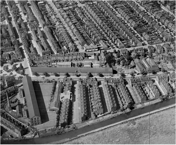 Photo Credits: http://www.lentontimes.co.uk | 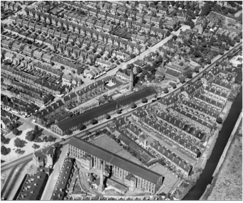 | 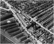 |
Alderney Street
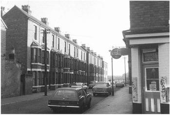 1 - Alderney Street, 1978. Looking from Castle Boulevard. The Picture 1 was taken in 1978 and shows the commerce at the corner of Alderney Street and Castle Boulevard that is still present in the site (see picture 3). The houses at the left were demolished to give space to the Castle Gardens Development in the beginning of 1980's. The Picture 2 shows the cleaned area after the demolition, before the start of the new buildings. ThePicture 3 shows the commerce at the corner, the new buildings at the left (where the old houses used to be) and back (that didn't exist in the past). The Picture 4 shows the new buildings at the east side of Alderney Street, constructed as part of Castle Gardens Development replacing the old houses showed in the Picture 1. Photo credits: Pictures 1 and 2: http://www.lentontimes.co.uk Pictures 3 and 4: Carolina Batista | 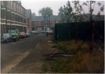 2 - Alderney Street, 1980's. Looking to Castle Boulevard. 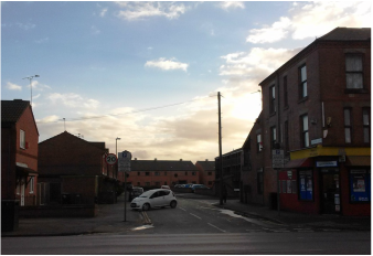 3 - Alderney Street, 2015. Looking from Castle Boulevard. 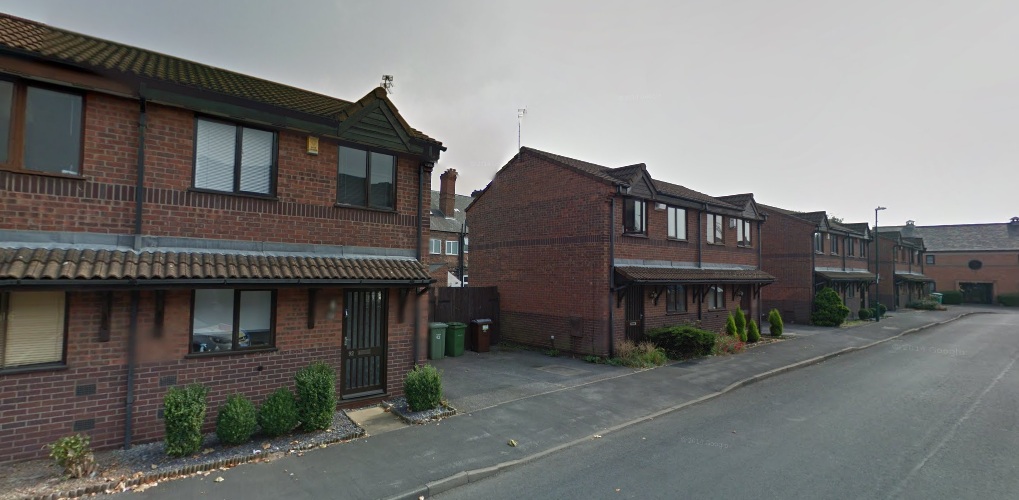 4 - Alderney Street, 2015. Looking from Castle Boulevard. |
Groove Road
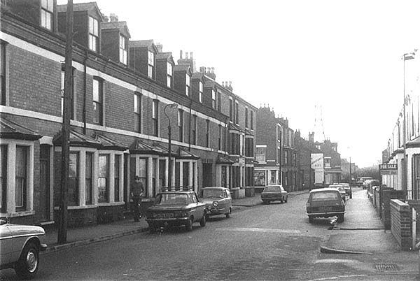 1 - Groove Road, 1978. Looking from Castle Boulevard. The Picture 1 shows the houses at East side of Groove Road in 1978 that were demolished to give space to the Castle Gardens Development at the beginning of 1980. The Picture 2 shows the houses at the West side of Groove Road, that still remains there, and The Groove in the back, that used to be a hotel. The Picture 3 shows the new buildings of Castle Gardens Development, that created a "Dead Façade" in the street. The Picture 4 shows the "dead façade" at the East side, the old houses at West that still remains and The Groove that now works like a public house. It seems that the Castle Gardens Development was created giving its back to the surrounding areas, creating dead façades, with no entrances or activities, in the Castle Boulevard and Groove Road. The front of the Development is on its central area, that is a private space, restricting the "safety feeling" to this area. Photo credits: Pictures 1, 2 and 3: http://www.lentontimes.co.uk Picture 4: Carolina Batista | 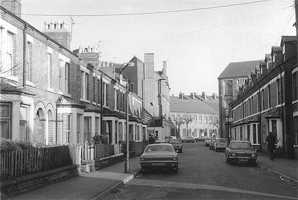 2 - Groove Road, 1978. Looking to Castle Boulevard. 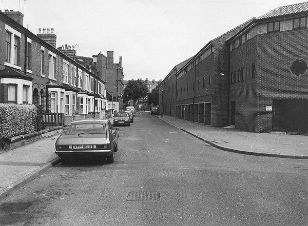 3 - Groove Road, 1988. Looking to Castle Boulevard. 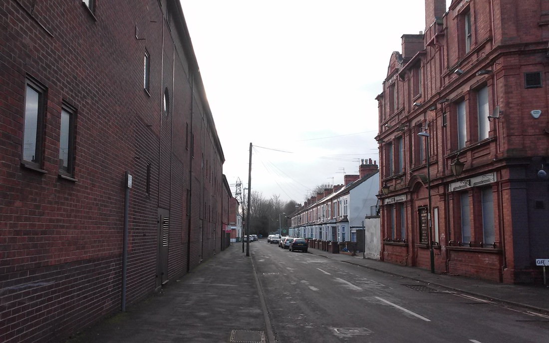 4 - Groove Road, 2015. Looking from Castle Boulevard. |
The Area
The following maps shows the changes in the area from 1880 until today. All the maps were taken from the Digimap Resource Centre website and can be accessed at http://digimap.edina.ac.uk/.
 | Current Shape The Map at left shows the current shape of the Project Area. In comparison to the previous layout, the major change is the presence of the Castle Gardens Development replacing the Elastic Yarn & Fine Wire Factory as well as some houses in the East side of the new stretch of Alderney Street, that replaced Marcus Street. |
 | 1980 Map The Map at left shows the central Elastic Yarn & Fine Wire Factory that supressed some houses at Marcus Street, both at East and West. The Lace Dressing Works at North of Castle Boulevard had already been demolished. In addition, the Nottingham Canal Marina is first shown. |
 | 1910 Map The Map at left shows The Lace Factory at the centre, surrounded by Alderney Street at SouthWest, Groove Road at West and Marcus Street at East. No one of the surrounding houses had been demolished at this time. |
 | 1880 Map The Map at left shows the area in 1880 when no building were built yet and there was only the York Gardens in the place. |
 RSS Feed
