Final Analysis Board

Site Location

|
Key Routes
Vehicular Routes
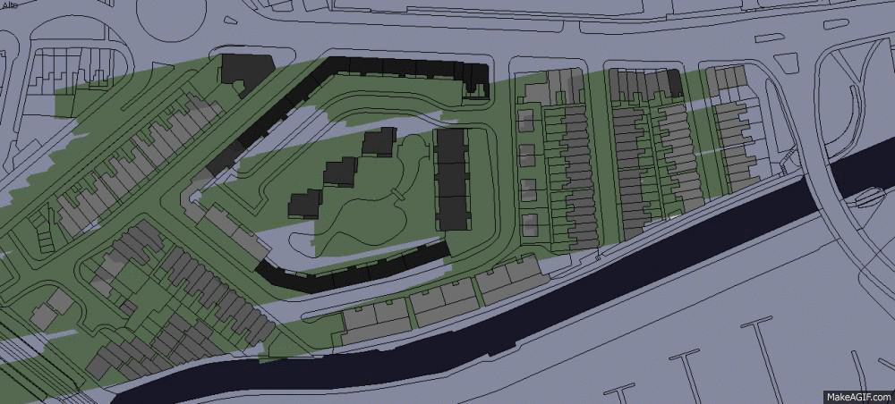
The main access to the area is through the Castle Boulevard. Cecil Street and Chippendale Street are both tight, dead-end streets, which makes it diicult for the residents get in and out with their cars.
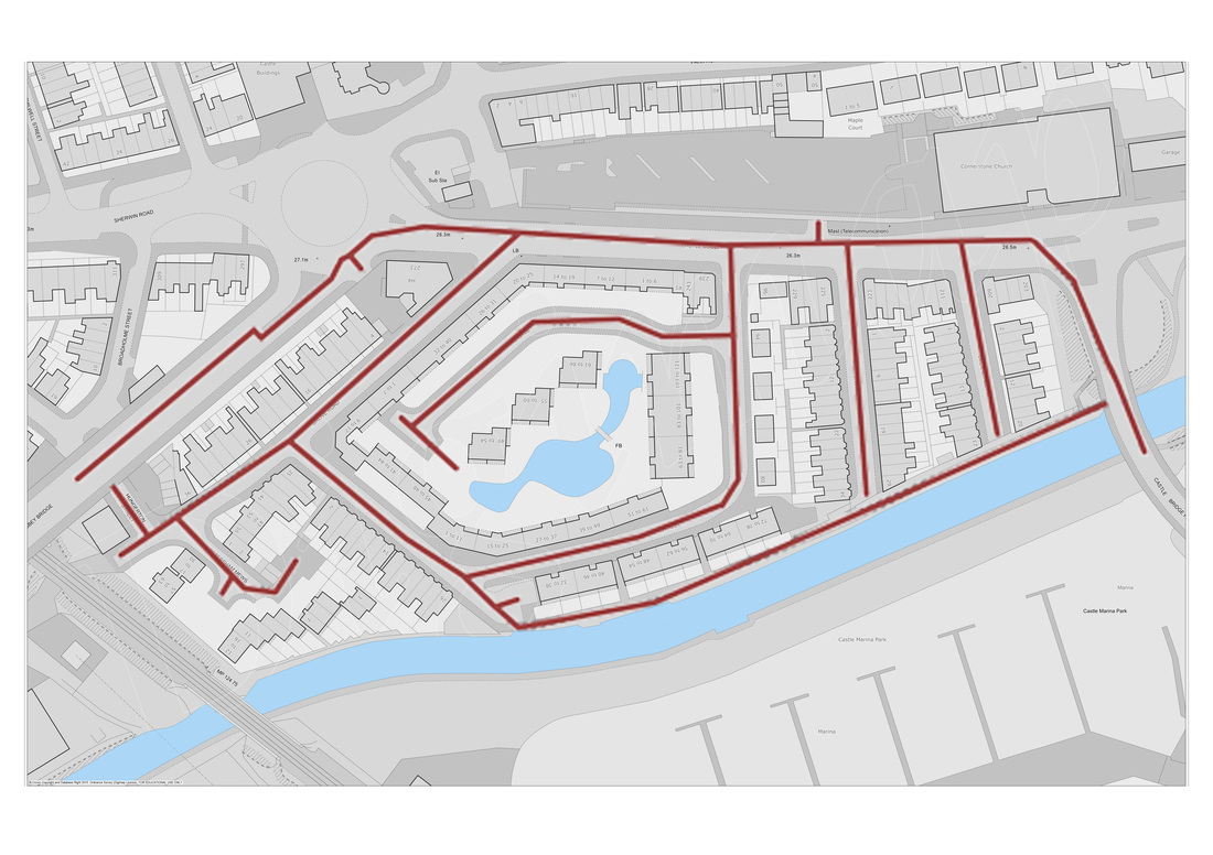
Pedestrian Routes
Pedestrians can access basicaly the same areas as the vehicles, with the additional canal pathway. The central area is private and can only be accessed by residents.
|

Long Section

Short Section
|

|
Solar Analysis
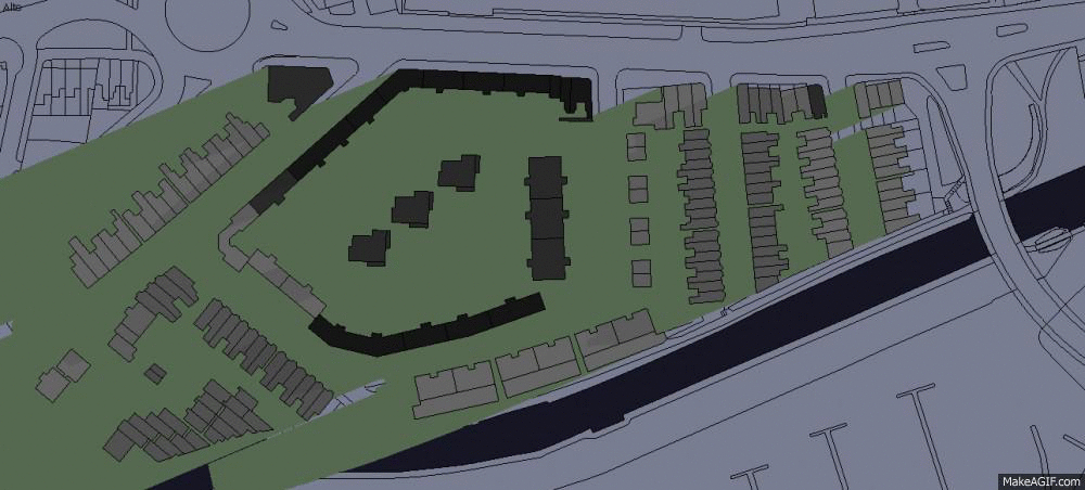
Aiming to understand how the insolation affects the area, a model was created using SketchUp from an AutoCAD base map available on the Digimap Resource Centre (digimap.edina.ac.uk). The different shades of grey indicates the different highs of the buildings, from darker grey for higher buildings to lighter grey for lower buildings.
Solar ChartThe Solar Chart for the project area was created using the program Analysis SOL-AR 6.2. It considers the local Latitude to generate the chart. For this project, it was the Latitude of Castle Garden Development:
12-41 Castle Gardens Nottingham NG7 1HH, UK 52.946252, -1.170609 Source: Google Maps 
|
Sun Path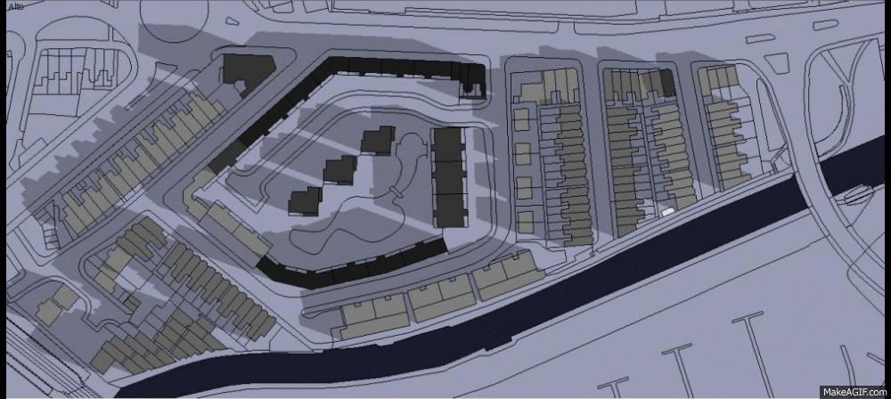
Winter
Summer
Equinox
|
Prevailing Wind Direction
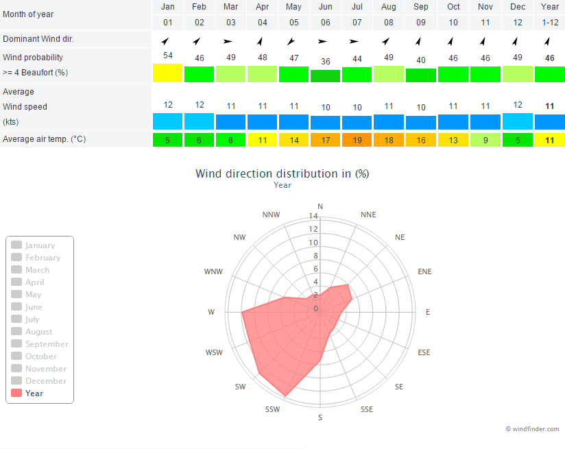
The table and graphic below shows the wind directions for Nottingham in 2014. It indicates that the average direction for the year was SSW, which means that the wind comes from SSW (slightly more from the South than from the South-West). It is the prevailing direction for Autumn and Winter. Spring and Summer has mixed directions, but still presents SSW wind.
The graphic was provided by the website windfinder.com. According to the website, the wind statistics are based on real observations from the weather station at Nottingham East Midlands.
The graphic was provided by the website windfinder.com. According to the website, the wind statistics are based on real observations from the weather station at Nottingham East Midlands.